Ship Detection in Satellite Imagery using YOLOv8
Overview
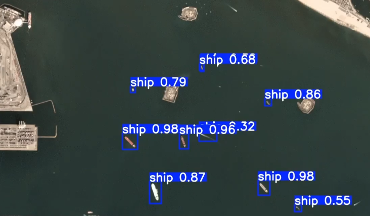
This project focuses on detecting ships in satellite imagery using the YOLOv8 object detection model. A pretrained YOLOv8s model was fine-tuned on a Kaggle ship detection dataset to identify ships in unseen satellite images. The project demonstrates the complete workflow from dataset preparation to model training and inference.
Key Features
- Ship detection in satellite images
- Fine-tuned YOLOv8s model
- Training on a Kaggle dataset
- Detection on unseen test images
- Confidence threshold comparison during inference
Workflow
- Prepare and organize the dataset.
- Configure the dataset using a YAML file.
- Train the YOLOv8s model.
- Validate the trained model.
- Perform inference on test images.
- Visualize the detection results.
Technologies Used
- Python
- YOLOv8 (Ultralytics)
- OpenCV
- Matplotlib
- Jupyter Notebook
Dataset
- Source: Kaggle
- Task: Ship Detection in Satellite Imagery
Results
| Metric | Value |
|---|---|
| Model | YOLOv8s |
| Training Epochs | 100 |
| Precision | 92.24% |
| Recall | 94.44% |
| mAP@0.5 | 97.84% |
| mAP@0.5:0.95 | 54.04% |
Future Improvements
- Improve detection accuracy with additional training data.
- Experiment with larger YOLO models.
- Optimize hyperparameters.
- Deploy the model as a web application.