Car Detection using GeoAI Mask R-CNN
Overview
This project demonstrates automated car detection from high-resolution aerial imagery using the GeoAI framework. A Mask R-CNN model was trained on labeled vehicle data to detect cars and generate vector outputs for geospatial analysis.
Key Features
- Object detection using Mask R-CNN
- High-resolution aerial imagery analysis
- Training with annotated vehicle datasets
- Automated inference on new imagery
- Vectorization of detected objects
- Visualization of detection results
Project Workflow
- Load aerial imagery and training labels.
- Create image tiles for model training.
- Train the Mask R-CNN object detection model.
- Perform inference on unseen imagery.
- Generate prediction masks.
- Convert predictions into vector polygons.
- Visualize the final detection results.
Technologies Used
- Python
- GeoAI
- Mask R-CNN
- Rasterio
- GeoPandas
- Matplotlib
- Jupyter Notebook
Dataset
- Input: High-resolution aerial imagery
- Training Labels: GeoJSON annotations
- Task: Car object detection
Results
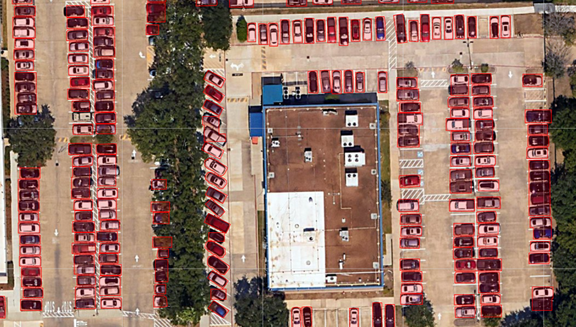
| Metric | Value |
|---|---|
| Model | Mask R-CNN |
| Pretrained Weights | Yes |
| Training Epochs | 100 |
| Learning Rate | 0.005 |
| Batch Size | 4 |
| Validation Split | 20% |
Future Improvements
- Improve detection accuracy with additional training data.
- Experiment with different backbone architectures.
- Optimize inference speed for large datasets.
- Deploy the workflow for large-scale geospatial object detection.