Tamil Nadu Crop Mapping using Deep Learning
Overview
This project demonstrates a crop mapping workflow using Sentinel-2 satellite imagery over an agricultural region in Tamil Nadu. The workflow includes satellite data acquisition, image preprocessing, temporal comparison, spectral analysis, and crop classification to identify agricultural patterns.
Key Features
- Download Sentinel-2 imagery using STAC API
- Satellite image preprocessing and normalization
- Temporal comparison of multi-date imagery
- Spectral index calculation
- Crop classification workflow
- Visualization of crop mapping results
Project Workflow
- Define the study area.
- Download Sentinel-2 satellite imagery.
- Preprocess and normalize the imagery.
- Compare multi-temporal satellite images.
- Calculate spectral indices.
- Perform crop classification.
- Visualize the mapping results.
Technologies Used
- Python
- Sentinel-2
- Rasterio
- NumPy
- Pandas
- Matplotlib
- PySTAC Client
- Jupyter Notebook
Dataset
- Source: Sentinel-2 Satellite Imagery
- Study Area: Perani, Villupuram, Tamil Nadu
- Data Access: AWS Earth Search STAC API
Results
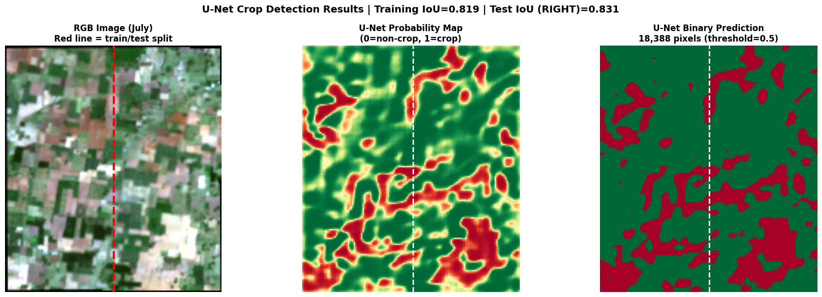
| Metric | Value |
|---|---|
| Model | Simplified U-Net |
| Training Epochs | 15 |
| Accuracy | 86.70% |
| Precision | 89.84% |
| Recall | 91.68% |
| F1-Score | 90.75% |
| IoU | 83.06% |
Future Improvements
- Apply deep learning semantic segmentation models.
- Integrate additional spectral bands and vegetation indices.
- Improve classification accuracy using larger datasets.